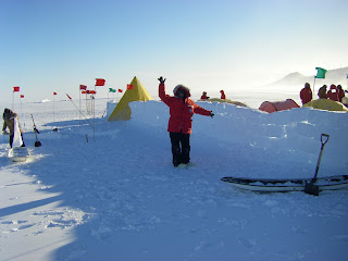
Wright Valley in the evening

Sunday, October 30, 2011

Walk to Scott Base

On Sunday Jen and I walked over to Scott Base, the New Zealand base ~3 km away. Walking to that part of Ross Island you can see glacial pressure ridges at the edge of the ice shelf. Ice pressure ridges form when two ice sheet collided and ice cracks and rises upward. The collision could result from wind or tidal forces, movement of ice via ocean currents, or heating and cooling of the ice causing it to alternately shrink and expand. In this cause, it is thought that the pressure ridges form from tidal forces.

Field of pressure ridges just to the east of Scott Base. 
Close-up of the pressure ridges in previous picture.
Fun sign at Scott Base listing distances (in kilometers) to different cities all over the world.

Thursday, October 27, 2011

Happy Campers School: Training for winter camping

When you come to Antarctica for the first time you are required to attend "Happy Campers" school. It is a ~36 hour class designed to teach people how to camp in the snow. The USAP (US Antarctic Program) want to ensure that everyone is able to use the materials provided in survival bags in the event you get stuck out in the harsh Antarctic environment and you feel confident that you can survive. The Happy Campers camp had some classroom activities where we learned about using radios and helicopter safety, but most of the class was outside learning how to set up tents, use camping stoves, build a snow wall a snow kitchen and (if you really wanted) you had the option of building a snow trench to sleep in. The snow trenches are supposed to be much more quiet than a tent because there is no fabric to flap around in the wind. 

During my field camp we did not have the best weather. Most of the time we experienced weather condition 2, meaning the wind speeds are less than 55 knots (click here to calculate this speed in different units), visibility is less than 0.25 miles, and wind chill temperature is between -75 and -100 degrees Fahrenheit. A few times we deteriorated to condition 1 (which is windier and colder than condition 2) and the evening of our first day we experienced condition 3, which is clear skies and not so windy and cold as condition 2. 

Arriving at Happy Campers the weather was less than ideal. We had high winds and low visibility.

Me proudly displaying the snow wall we had to build to protect our tents from the high winds. I'm wearing all of my ECW (Extreme Cold Weather) gear to keep me warm. This is the brief period of time where we had condition 3 weather.

Wednesday, October 26, 2011

Pictures from the flight down

Me on the flight down to McMurdo Station.

View out the plane window. Transantarctic mountains with alpine glaciers visible. 
 As we neared the Antarctic continent we began to see patches of broken ice that slowly evolved to mountains with glaciers. In Antarctica there are two main types of glaciers, alpine glaciers and ice sheets. Alpine glaciers are glaciers that flow down valleys between mountain peaks. Snow accumulates near the top of the valley and eventually with enough snow the glacier is able to flow down slope. Alpine glaciers can be found all over the world, even near the equator at high enough altitudes. Ice sheets are huge expanses of ice that form broad relatively flat deposits. Snow accumulates at a central location and then once enough material accumulates it flows outward from that location. Think (East) Antarctica and Greenland.

Monday, October 24, 2011

So many flights...


I thought I’d share our travel route with you all. We will be left from Boston, Massachusetts to fly all the way to Christchurch, New Zealand. It took us two days to get all the way from the east coast of the United States to New Zealand. This is both because it is a very far distance and we have to cross the International Date Line. Crossing the line from east to west results in adding a day to our trip without us actually experiencing those hours. On the way back we will subtract a day and arrive on the east coast the same day we left New Zealand.

Yesterday we collected all of our cold weather gear for the field and early this morning we flew out to McMurdo Station in a C-17. It is a HUGE military plane that was carrying people and equipment down to the base. In about a week we’ll finally head out to the McMurdo Dry Valleys. During that week the three of us will be busy running around to meetings and making sure all of our equipment is accounted for and assembled.
Labeled map of Antarctica, showing travel route in red (modified from United States Antarctic Program (USAP) image). 

Friday, October 14, 2011

Welcome


Hello everyone! My name is Jenny Whitten and I’m a graduate student traveling to Antarctica to do research with two colleagues, Kate Swanger (University of Massachusetts) and Jen Lamp (Boston University). We will be working in the McMurdo Dry Valleys to understand local climate change over the last few million years. To accomplish this goal we will be collecting rock samples and making measurements of rock properties.

The McMurdo Dry Valleys are a good place to study climate change because they are considered to be a polar desert. It is very cold (average temperature is -19ÂșC) and there is very little precipitation, meaning that the rocks erode very slowly. This slow erosion means the landscape does not change much, preserving a lot of important information in the geology.

Landsat 7 image of McMurdo Dry Valleys. Inset shows climate zones: Coastal thaw zone (CTA) in blue, Inland mixed zone (IMZ) in green and the stable upland zone (SUZ) in yellow. See Marchant and Head (2007) Icarus for more details.
In addition to studying climate change on Earth, the McMurdo Dry Valleys can be studied to better understand polar processes observed on Mars today. The reason we can use the McMurdo Dry Valleys as an analog for Mars is the weather. The valleys are very cold and dry, similar to conditions on Mars today. Similar climates allow scientists to extrapolate their observations and experiments and say what is observed on Earth may be occurring on Mars. Researchers have investigated features in the McMurdo Dry Valleys to compare with martian gullies, glaciers, patterned ground, etc. There is so much possibility in the McMurdo Day Valleys!

Over the next month or two I’ll be adding posts to further explain the research we are doing, how we can use the Dry Valleys as an analog for Mar, as well as other interesting geology we encounter.